


Seacoast Region--Rockingham County (Southern)--Portsmouth City PUMA, New Hampshire
About
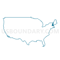
Outline
--Portsmouth+City+PUMA%2c+New+Hampshire_A280.png)
Summary
| Unique Area Identifier | 193367 |
| Name | Seacoast Region--Rockingham County (Southern)--Portsmouth City PUMA |
| State | New Hampshire |
| Area (square miles) | 449.47 |
| Land Area (square miles) | 361.80 |
| Water Area (square miles) | 87.68 |
| % of Land Area | 80.49 |
| % of Water Area | 19.51 |
| Latitude of the Internal Point | 42.94234350 |
| Longtitude of the Internal Point | -70.96681280 |
Maps
--Portsmouth+City+PUMA in New Hampshire.png)
Graphs
Select a template below for downloading or customizing gragh for Seacoast Region--Rockingham County (Southern)--Portsmouth City PUMA, New Hampshire
--Portsmouth+City+PUMA%2c+New+Hampshire_T0.png)
--Portsmouth+City+PUMA%2c+New+Hampshire_T1.png)
--Portsmouth+City+PUMA%2c+New+Hampshire_T2.png)
--Portsmouth+City+PUMA%2c+New+Hampshire_T3.png)
--Portsmouth+City+PUMA%2c+New+Hampshire_T4.png)
--Portsmouth+City+PUMA%2c+New+Hampshire_T5.png)
--Portsmouth+City+PUMA%2c+New+Hampshire_T6.png)
--Portsmouth+City+PUMA%2c+New+Hampshire_T7.png)
--Portsmouth+City+PUMA%2c+New+Hampshire.png)
Neighbors
Neighoring Public Use Microdata Area (by Name) Neighboring Public Use Microdata Area on the Map
- Essex County (Central)--Amesbury Town City PUMA, MA
- Essex County (East)--Salem, Beverly, Gloucester & Newburyport Cities PUMA, MA
- Essex County (Northwest)--Lawrence, Haverhill & Methuen Town Cities PUMA, MA
- Hillsborough County (Southeastern)--Greater Nashua City PUMA, NH
- Outer Manchester City PUMA, NH
- South Maine--York (West) & Cumberland (West) Counties PUMA, ME
- Strafford Region--Strafford, Rockingham (Northern) & Carroll (Southeastern) Counties PUMA, NH
Top 10 Neighboring County (by Population) Neighboring County on the Map
- Essex County, MA (743,159)
- Hillsborough County, NH (400,721)
- Rockingham County, NH (295,223)
- York County, ME (197,131)
- Strafford County, NH (123,143)
Top 10 Neighboring County Subdivision (by Population) Neighboring County Subdivision on the Map
- Haverhill city, Essex County, MA (60,879)
- Methuen Town city, Essex County, MA (47,255)
- Derry town, Rockingham County, NH (33,109)
- Dover city, Strafford County, NH (29,987)
- Salem town, Rockingham County, NH (28,776)
- Hudson town, Hillsborough County, NH (24,467)
- Londonderry town, Rockingham County, NH (24,129)
- Portsmouth city, Rockingham County, NH (20,779)
- Amesbury Town city, Essex County, MA (16,283)
- Hampton town, Rockingham County, NH (15,430)
Top 10 Neighboring Place (by Population) Neighboring Place on the Map
- Haverhill city, MA (60,879)
- Methuen Town city, MA (47,255)
- Dover city, NH (29,987)
- Derry CDP, NH (22,015)
- Portsmouth city, NH (20,779)
- Amesbury Town city, MA (16,283)
- Londonderry CDP, NH (11,037)
- Hampton CDP, NH (9,656)
- Exeter CDP, NH (9,242)
- Salisbury CDP, MA (4,869)
Top 10 Neighboring Elementary School District (by Population) Neighboring Elementary School District on the Map
- Derry School District, NH (33,109)
- Hampton School District, NH (15,430)
- Exeter School District, NH (14,306)
- Seabrook School District, NH (8,693)
- Stratham School District, NH (7,255)
- Rye School District, NH (5,298)
- Nottingham School District, NH (4,785)
- Chester School District, NH (4,768)
- Brentwood School District, NH (4,486)
- North Hampton School District, NH (4,301)
Top 10 Neighboring Secondary School District (by Population) Neighboring Secondary School District on the Map
- Exeter Regional Cooperative School District, NH (32,208)
- Winnacunnet Cooperative School District, NH (30,660)
Top 10 Neighboring Unified School District (by Population) Neighboring Unified School District on the Map
- Haverhill School District, MA (60,879)
- Methuen School District, MA (47,255)
- Dover School District, NH (29,987)
- Salem School District, NH (28,776)
- Timberlane Regional School District, NH (24,733)
- Hudson School District, NH (24,467)
- Londonderry School District, NH (24,129)
- Triton School District, MA (20,805)
- Portsmouth School District, NH (20,779)
- Oyster River Cooperative School District, NH (20,739)
Top 10 Neighboring State Legislative District Lower Chamber (by Population) Neighboring State Legislative District Lower Chamber on the Map
- State House District 27, Hillsborough County, NH (45,635)
- Fifteenth Essex District, MA (43,123)
- State House District 4, Rockingham County, NH (42,368)
- Second Essex District, MA (42,019)
- First Essex District, MA (41,982)
- Third Essex District, MA (41,038)
- State House District 5, Rockingham County, NH (33,109)
- State House District 3, Rockingham County, NH (29,082)
- State House District 13, Rockingham County, NH (25,862)
- State House District 8, Rockingham County, NH (22,157)
Top 10 Neighboring State Legislative District Upper Chamber (by Population) Neighboring State Legislative District Upper Chamber on the Map
- First Essex District, MA (170,805)
- State Senate District 17, NH (58,086)
- State Senate District 21, NH (57,893)
- State Senate District 23, NH (56,793)
- State Senate District 6, NH (56,650)
- State Senate District 22, NH (56,033)
- State Senate District 19, NH (55,224)
- State Senate District 14, NH (53,549)
- State Senate District 24, NH (53,314)
- State Senate District 1, ME (36,335)
Top 10 Neighboring 111th Congressional District (by Population) Neighboring 111th Congressional District on the Map
- Congressional District 1, ME (668,515)
- Congressional District 5, MA (662,269)
- Congressional District 2, NH (658,486)
- Congressional District 1, NH (657,984)
- Congressional District 6, MA (650,161)
Top 10 Neighboring Census Tract (by Population) Neighboring Census Tract on the Map
- Census Tract 123, Hillsborough County, NH (8,930)
- Census Tract 121, Hillsborough County, NH (8,201)
- Census Tract 650.01, Rockingham County, NH (7,874)
- Census Tract 1004, Rockingham County, NH (7,729)
- Census Tract 1011, Rockingham County, NH (7,609)
- Census Tract 1061.01, Rockingham County, NH (7,264)
- Census Tract 670, Rockingham County, NH (7,255)
- Census Tract 675.01, Rockingham County, NH (7,252)
- Census Tract 36.01, Rockingham County, NH (6,817)
- Census Tract 1031, Rockingham County, NH (6,751)
Top 10 Neighboring 5-Digit ZIP Code Tabulation Area (by Population) Neighboring 5-Digit ZIP Code Tabulation Area on the Map
- 01844, MA (47,249)
- 03038, NH (33,269)
- 03820, NH (30,039)
- 03079, NH (28,776)
- 01830, MA (25,137)
- 03051, NH (24,480)
- 03053, NH (23,957)
- 01832, MA (22,060)
- 03801, NH (21,532)
- 03833, NH (20,955)